Saturday, 26 January 2013

Comox Valley North - Recreation & Beaches


  Post #7a  - Recreational areas & beaches - Comox Valley North

There are 26 posts in this blog, please visit them all.

<<<< See side bar for more


   A Pictorial View of the Comox Valley

Recreational areas in the Comox Valley
North of the City of Courtenay   

                                _________________________                                                           

Kitty Coleman Beach & Park

Location 
Kitty Coleman Beach & Park is located 6 kilometers northwest of Courtenay on central Vancouver Island. This park is accessed via Coleman Road off Hwy 19A, north of Courtenay. Turn on Left Road, then right on Whittaker Road until you reach the park. Nearby communities include Courtenay, Comox Valley, Merville and Campbell River.

Situated on the south side of the Strait of Georgia, Kitty Coleman Provincial Park is a popular destination for swimming, boating, fishing, hiking and oceanfront camping. The  park protects the mature forest of Western hemlock, Western red cedar and Douglas fir in the upland portion, the estuary of Kitty Coleman Creek, and 900 meters of shoreline. Park facilities include a picnic shelter, picnic tables, pit toilets, two boat launches, several nature trails and camping for individuals and groups.

History - The original park was donated to the settlers of Merville around 1900 and operated by the community until the 1940s, when financial difficulties led to the province assuming management responsibility. Kitty Coleman was established as a Class “C” Provincial Park in 1944, and a community park board was set up to oversee its operation.

 Special Features: The eastern portion of the park is home to a single majestic old-growth Douglas fir, estimated to be more than 500 years old. Wild onions can also be found growing throughout the area. Kitty Coleman Park is located 6 kilometers northwest of Courtenay on central Vancouver Island. This park is accessed via Coleman Road off Hwy 19A, north of Courtenay. Turn on Left Road, then right on Whittaker Road until you reach the park. Nearby communities include Courtenay, Comox Valley, Merville and Campbell River.      

Some of the above information is from the following web site.
http://www.env.gov.bc.ca/bcparks/explore/parkpgs/kitty_coleman_bch/

Kitty Coleman Beach & Park       


 Sign at Kitty Coleman Beach Entrance

 Kitty Coleman Beach

Kitty Coleman Beach Douglas Fir
          ________________________________________________________

                                          Bates Beach 


 Road sign at the end of Aldergrove Road and the access to a section of Bates Beach
You will notice the birth and death date of Davey Janes on the road sign, this is the first time I have seen dates on regular road signs.  David William Janes born 1912 and died 2002, was first a logger then a fisherman, he was married, his wife's name Sally Janes, his children, Greg Janes and Norma Janes. 
(Thank you to Norma Janes for sending me the correct information on the family, RR)

                                         Bates Beach
Bates beach is the name of a community along the Georgia Strait. There is a beautiful Oceanfront Resort in the area which has camping, boating, kayaking, fishing and more. There are a few public access points to the waterfront which is mostly rocky, with tidal pools and sand bars. 


 Bates Beach area at the end of Davey Janes Road

 Bates Beach area at the end of Davey Janes Road

A section of Bates Beach   

____________________________


Seal Bay Park

History

The park was originally part of a larger area offered to W.W.I soldiers as settlement lands. The soldiers opted not to claim the lands leaving the area as Crown land. In 1971 the Comox-Strathcona Natural History Society started lobbying the regional district and provincial government to have the area designated as a park. In 1975 approx. 135 ha (335 acre) were leased to CVRD as a park for a 20 year term.  In 1985 the area under lease was Crown granted to the regional district. An additional area of approx. 16.2 ha (40 acre) was added on with another Crown grant in 1988.

The area was last logged in approximately 1913 with cutting ending in the early 1920s. Springboard marks are still visible on the old growth stumps. Several trails follow rail or logging grades once used to haul cut trees. There was a small Japanese camp on the beach along with a sawmill where the Seabank Road trail reaches the water.

http://www.comoxvalleyrd.ca/section_parks/content.asp?id=137&collection=15

 Sign at entrance to Seal Bay Park
 Alex checking out the trees on pathway at Seal Bay Park
 Beach area at Seal Bay Park
 Map showing trails at Seal Bay Park
 Plaque for Jim Egan at Seal Bay Park
 Plaque for Jim Egan is on this burl at Seal Bay Park

__________________________

 Miracle Beach

Located on the waterfront midway between Courtenay and Campbell River, this park provides easy access to both communities and a wealth of entertainment. On the beach, sandcastle building, sunning, swimming, exploring tide pools or just frolicking along the shore are all part of the Miracle Beach experience. And don’t miss the non-competitive annual sandcastle building day in June, where playful people of all ages create fantastic sculptures for all to enjoy....................

Miracle Beach Provincial Park is located 22 km north of Courtenay and 22 km south of Campbell River off Hwy 19a. From Hwy 19 take exit #144 (Hamm Road) to Hwy 19a (the Oceanside Route). Head north a short distance to Miracle Beach Drive, then drive 2 km straight into the park. Nearby communities include: Campbell River, Comox Valley, Merville

Beach area at Miracle Beach

Beach area at Miracle Beach

Women's Fitness Day at Miracle Beach
"Tug of War" time

Sand Castle Competition at Miracle Beach
This picture was taken a few years ago
_______________________________________________________ 


Saratoga Beach

Next door to Miracle Beach is sandy Saratoga Beach. With its many resorts and campgrounds, Saratoga Beach is a good alternative if Miracle Beach is full. For your convenience the park has a concession managed by the Park Facility Operator.
The popular resort area of Saratoga Beach, located at the mouth of the Oyster River at the far north end of the Comox Valley, is considered by many vacationers as one of the prime beaches on sheltered east coast of Vancouver Island. The tide along this part of the coast goes out for over a quarter of a mile, creating a sandy oceanfront playground perfect for children. The gently sloping beach extends for more than a mile into the calm waters of the Strait of Georgia, creating safe, warm and  shallow swimming conditions, free from deep water, strong currents, deep water or powerboat traffic. Saratoga Beach is flanked by popular Miracle Beach Provincial Park to the south and Oyster River Regional Park to the north.  
The Old Island Highway, also known as the "Oceanside Route" ( BC Highway #19A ) passes through Saratoga Beach about 25 minutes north of the central Comox Valley city of Courtenay, and 15 minutes south of Campbell River.
 Strathcona Beach

_______________________________


 Puntledge River
also popular fishing area

          
 Puntledge River (Condensory Bridge )
Puntledge River looking north from Condensory Road Bridge
Great for swimming, fishing, Kayaking 

Swimmers waiting to jump into the water at Condensory Bridge

The Puntledge River showing the old logging railway trussel

    Stotan Falls

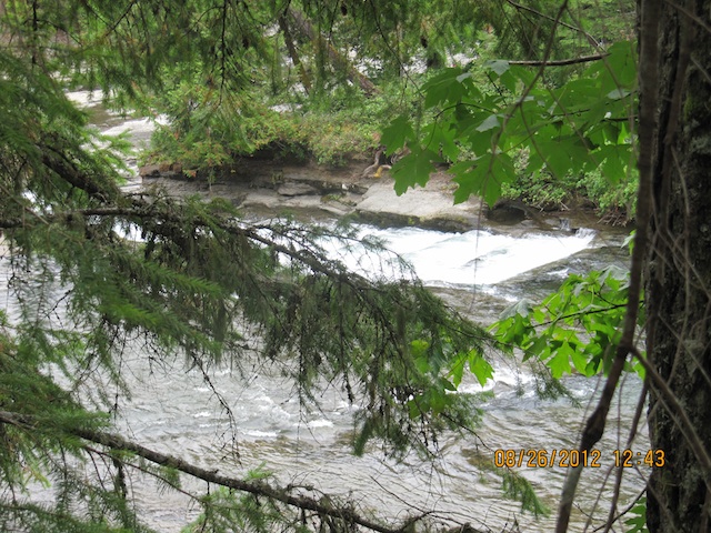
Stotan Falls. Short trails leading to waterfalls. Great for suntanning on large boulders in the summer and spectacular autumn colours during the fall. Access via Lake Trail Rd to Duncan Bay Main Rd.
The correct spelling is really STOKUM FALLS. If you ask anyone who grew up in the Comox Valley they will tell you that this is the correct spelling. A few years back the province put up new signage around Courtenay and INCORRECTLY labelled the area as Stotan Falls.
http://wikimapia.org/2614884/Stotan-Stokum-Falls


 Stotan Falls as viewed from Bridge

 Stotan Falls 

 Stotan Falls 

 Relaxing at Stotan Falls


______________________________________________________
 Nymph Falls

Nymph Falls Nature Park : Well maintained mountain biking, hiking and walking trails. Nymph Falls Park is an extensive network of trails for all skill levels spanning over 55.4 acres. A shorter loop trail is also available leading to the fish ladders and Nymph Falls. Access from Forbidden Plateau Rd.
 Nymph Falls showing fish ladders

Swimming at Nymph Falls
           _________________________ 
                     
Barbers Hole

Barber's Hole is just north of (adjacent to Nymph Falls Regional Park)
- it is part of the BC Hydro recreational site.


 Barber's Hole
Picture from "AboutComox.com"
Thank you for the picture

Barber's Hole or Boubors Hole
Forest paths and a deep swimming pool surrounded by large boulders in the Nymph Falls Nature Park.  Access via the dirt road before the fish hatchery on Forbidden Plateau Road.

_______________________________________

Medicine Bowls

 Medicine Bowls is located off Forbidden Plateau Road just before you really start to
climb up to Forbidden Plateau.


Medicine Bowls Trail. Three waterfalls born from Browns River carved out by the force of nature and rushing currents. Medicine Bowls Trail is a great hike for novice walkers offering spectacular views after a short 2 km walk on a dirt road at the end of Forbidden Plateau Road west of Courtenay, BC

In the summer the river ebbs, and you are left with fabulous "bowls" of water, just like a hot tub! The rock is sandstone.so it gets real hot.
Thank you for the great picture, check this web site for more information and pictures
                 __________________________________________________

Browns River 

Another area that is very popular in the summer.
http://raftinglife.ca/?p=74 for some great photos of Upper Browns River

_______________________________


  The next post is


or
  Click the posts under Categories for more views of our valley
<<<<<<<<<<<<<<<<<<


_____________________________

This page is copyrighted, please contact the author at rhodaross@telus.net for permission to use.


1 comment:

  1. contact information - my new e-mail is rhodapross@shaw.ca

    ReplyDelete